
Traffic APIs
Put live traffic information into your apps
Track traffic density, travel times, and individual incidents all with the same suite of APIs.
Fast. Responsive. Precise.
Azure Maps traffic data APIs empower your app development with the ability to create real-time traffic solutions with macro and micro views.
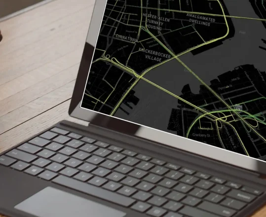
Traffic Flow
Look at macro views of traffic in precise detail. Compare average speeds, travel times, and traffic density.
Incident Reports
Synchronize data between calls and APIs. Determine currency of traffic incidents and update by the minute
Incident Viewports
View information regarding technical specs and legal classifications for each traffic incident report.
Incident Tiles
Consolidate incident reports with 256 x 256 pixel tiles that put incidents into a concise grid system.
Predictive Routing
Use Azure Maps Traffic APIs to combine traffic flow, incident reports, and powerful calculations to predict traffic patterns and anticipate disruption before it occurs. Improve route suggestions, logistical planning, and fleet operational patterns.
ETA Optimization
Employ traffic data APIs in route planning to update and improve ETA estimates. Build better initial estimates and more accurate ETA updates in transit.
Incident Comparison
Compare traffic incidents along competing routes in real time to scale disruption and choose the best possible option in any given moment.
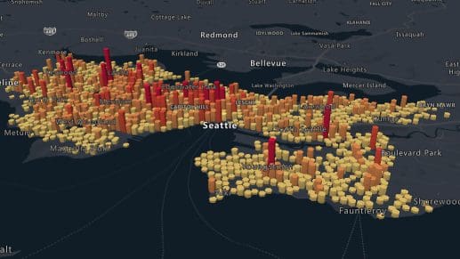
Design at Scale
Azure traffic APIs work at scale. Get the same benefits when prototyping a small-scale app and seamlessly upgrade support as the app grows.
Traffic in your apps
Traffic APIs come included with your Azure Maps account. They provide real-time reporting that allows you to optimize routing and monitoring for your map apps.
Integrated Tools
Other Azure Maps APIs for Traffic Intelligence

Data Management
Azure Map services make it easy to find and store geospatial data. Use this to lower latency, customize app scenarios, and improve app performance.

Geolocation
Azure Maps’ geolocation services allow you to resolve the IP addresses from a range of mobile and fixed internet traffic sources to determine the ISO country code of that IP traffic. This enables the localization of services and content for your application.

Ready to start building?

Get started
Our platform provides you with everything you need — from subscription keys for API authentication to a plethora of code samples, demos and SDKs.

Documentation
Complete with code samples, SDK support, and detailed explanations, this is a one-stop resource for enhancing your projects with the wide range of Azure Maps APIs.

Samples
These pre-written snippets show how to perform various API calls for current weather, forecasts, and severe weather alerts, among other functionalities.
Frequently asked questions
-
You can access the traffic data APIs with your Azure account, which is free. To use the APIs, you will need to provide billing information, as pricing depends on usage. Each account gets a set number of free API calls (subject to change). After that threshold, prices follow tiers based on the number of calls.
-
The APIs do not have clear preset limitations. That said, Azure Maps does set QPS (queries per second) limits. These limits increase with your subscription tier, maxing at above 500 QPS.
-
While there are no daily limits on searches users can perform using Azure Maps Search API, there are limits on the number of queries per second (QPS). QPS limits vary depending on the selected pricing tier.
-
The many traffic tiles available fit into three categories: traffic flow, traffic incident, and incident detail.
-
Apps and systems already utilizing Bing Maps traffic data APIs can migrate directly to Azure maps. Follow the official tutorial for step-by-step instructions.

Azure Maps
Advanced mapping and visualization features for your applications.
More features from Azure Maps

Data and Insights
Process and analyze massive amounts of real-time and historical location data with Azure Data services to find the best possible solutions to logistics challenges.

Location Services
Map supply chains, locate POIs, and create customized experiences with powerful geolocation data, all backed by robust search APIs and extensive GIS databases.
Mapping and Visualization
Create varied, fully customizable, and interactive graphs that inform creative decision-making. Experience a new way of visualizing your data.