Azure Maps APIs for emergency response
Immediately following an emergency, accurate and reliable geospatial information is critical for an effective response. Azure Maps APIs help you direct disaster management and response efforts. Azure Maps’ suite of comprehensive geospatial tools offers you exactly that, as well as consistent environmental monitoring for pre-disaster risk assessments.
Rapid Mapping
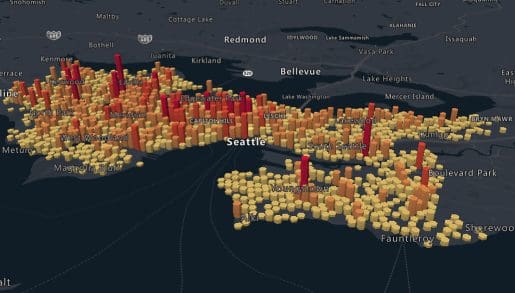
Highly accurate mapping that lets you assess the situation before an event, identify the areas most affected, and evaluate the severity of damage.
Routing and Disaster Relief
Identify the best way to dispatch relief efforts following a disaster via air, water, and land routes that remain safe to traverse.
Weather Updates
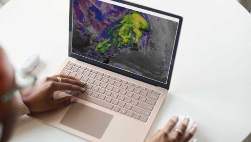
Get up-to-the minute weather information, including alerts current and historical information to predict an event, as well as alerts for storms and heavy weather.
Prevention and Preparedness
Plan and manage disaster response through floodplain mapping, wildfire risk assessment, tidal warnings, and more by overlaying sensor data with other data sources.
Built for mission critical applications

Data and Insights
Process large volumes of event and pattern data, including from your own sources, to generate actionable intelligence.

Location Services
Use Geocoding and Geolocation among other location services to identify POIs and access relevant data points for an area.

Mapping and visualization
Leverage satellite and aerial imagery combined with state-of-the-art mapping to create custom visualizations.

Weather
Keep up-to-date with near real-time weather data as well as projections to inform disaster management and response.
Frequently asked questions
-
Azure Maps APIs are a set of comprehensive geospatial tools that let you assess the probability of a disaster as well as evaluate damage in a dynamic fashion following one. Our cutting-edge platform helps you lessen the impact of a disaster and streamline relief efforts.
-
Azure provides accurate, reliable mapping for disaster management and response that lets you identify the most vulnerable areas and the best transportation routes to get there quickly and safely. This can enable emergency responders to reach their destination quicker to help those affected.
-
Azure Maps APIs offer you near real-time current weather information, including severe weather alerts, as well as historical data and projection to support weather modeling and disaster relief efforts.
-
Yes. Azure’s powerful mapping solutions let you conduct risk assessments for potential catastrophes, including wildfires, flooding, and severe weather phenomena, allowing you to put an effective disaster management and response plan in place.
-
Yes! Azure Maps is highly flexible and can be tailored to any disaster mapping use case. You can integrate our own robust geospatial data with your own data sources to create custom visualizations that allow your teams to quickly react following an event.


