

Geolocation API
Quick, accurate location identification.
Identify the originating country or region for any IP address with the Azure Maps IP Geolocation API to localize your services.
Localize with confidence.
Azure Maps APIs are versatile toolsets designed to support a variety of use cases, helping bolster your applications with precise location intelligence.
ISO Country Code
Resolve any IP address into a two- or three-letter country code.
REST API
This API can be easily integrated with other Azure Maps and third-party APIs.
Access Control
Designate who can and cannot access geolocation data via built-in and custom role creation.
Localization Support
Azure Maps offers you truly global coverage with localization support in dozens of languages.
Flawless IP Geolocation
The Azure Maps Geolocation API can parse the IP address from any of a range of traffic sources, including mobile and fixed-line internet networks. This REST API uses the IP to determine the country or region code from which traffic originates and enables your developers to customize content or services based on the location.
Role-based Access
Azure role-based access control (RBAC) provides fine-grained access management to Azure Maps resources.
Global Coverage
Azure Maps offers you outstanding worldwide coverage with language support in dozens of global languages. Building truly local geolocation technologies is easier with a global REST API.
Local Search
The Geolocation API can be combined with Search and other Azure Maps APIs to further enhance user experiences on your platform. Surface points of interest relevant to your users’ accurate coordinates, and build more accessible solutions with autosuggest and fuzzy search.
REST Architecture
This IP Geolocation API leverages REST architecture for seamless integration with other third-party services and Azure Maps APIs, such as the Geocoding API.
Pay-as-you-go
With Azure Maps, you only pay for what you use. Every service, including the Geolocation API, offers you a certain number of free transactions, so you can get started without paying upfront.
Azure Maps Geolocation Service
The Geolocation service, part of the Azure Maps suite, offers you precise location targeting. Along with all the other toolsets on offer, you can create a wide range of solutions imbued with rich location data to contextualize places and personalize your services.
Azure Maps APIs
More geospatial functionality

Search
The Azure Maps Search API lets you look up anything from addresses to business listings and other establishments to build rich location-powered experiences for your users.

Geocoding
The Azure Maps Geocoding API can translate any global address, such as a street intersection or even a geographical outline, into a set of latitude/longitude coordinates for use in mapping and other applications.

Azure Maps Geolocation API
Discover the power of precise location intelligence
Ready to start building?

Get started
Sign up for free and start building today. Get subscription keys for API authentication, code samples, and demos on our platform. Get started with Azure Maps.

Documentation
This one-stop resource covers everything you need to get the most out of the IP Geolocation API, including code samples, SDK support, and tutorials.

Samples
Access a free code sample gallery featuring pre-written snippets and interactive code that shows you how to perform various API calls, including route creation, weather forecasts, and more.
Frequently asked questions
-
The Azure Maps suite of toolsets relies on a comprehensive database of geospatial data, which is continuously updated for relevancy. Advanced search algorithms and address validation services support our Geolocation API, allowing it to resolve an IP address into an accurate street-level address for applications such as routing and delivery.
-
No. You can make as many queries as you like. The first 5,000 transactions are free with volume-based pricing and discounts subsequently. Browse through our pricing tiers for more information.
-
Yes! Azure Maps API offers practically infinite customizations in how you can visualize your map. Once you’ve geolocated a destination pin, you can apply anything from traffic and weather overlays to routing services and more.
-
You can get started for free with an Azure Maps account. Up to the first 5,000 transactions for the IP Geolocation API are free, following which you pay only for the volume of transactions you use. Browse our pricing tiers for more information.
-
high accuracy and versatile toolsets that let you create robust and useful location-powered solutions. Get practically perpetual uptime and 24/7 customer support with Azure Maps API.

Azure Maps API
Advanced mapping and visualization features for your applications.
More features from Azure Maps

Data and Insights
Process and analyze massive amounts of spatial data with Azure. Leverage high-accuracy imagery and spatial data to solve complex logistics challenges.

Location Services
Integrate the Geolocation API with other Location Services APIs to locate POIs and build tailored search experiences for users everywhere.
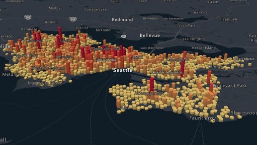
Mapping and Visualization
Bring your data to life with a powerful suite of mapping and visualization tools. Empower your decision-making and find new ways to grow with spatial data.