Make every journey your own
From simple A to B travel for individuals to commercial journeys spanning multiple terrains. Azure Maps’ Routing APIs add context to each route with real-time, relevant location data, including weather, traffic, and much more.
Real-time Data
Think ahead with Azure Maps, avoiding congested roadways, closures, and constructions using real-time data.
Multiple Vehicles
Generate unique routes for every vehicle, including cars, trucks, motorcycles, and more.
Modify Route Types
Pick from multiple route types for every journey, including fastest, shortest, eco, and thrilling, to get directions.
Optimize Resources
Save on fuel, energy, and time by mapping directions based on your vehicle’s resource consumption models.
Route Range
The Directions API allows users to do more with their fleet. Find the maximum possible traversable distance for every vehicle based on the available resources, including time, fuel, or charge. Whether you’re optimizing routes for an EV-powered fleet or managing conventional diesel-powered trucks, Azure Maps API adapts to your needs.
Geocoding and Reverse Geocoding
Use the geocoding service to convert addresses into simple geographic coordinates for easy direction mapping, or vice-versa with reverse geocoding. Azure Maps API also supports batch geocoding and reverse geocoding, helping developers save precious resources while processing hundreds of addresses at a time.
Location Data
Work with Azure’s robust data infrastructure to build reliable routing solutions. Access local weather, traffic, and satellite imagery data to generate multilayered routes through the Directions API. Build truly location-aware apps powered by accurate location data, including route-relevant information on nearby POIs, to get the most out of every journey.
Azure Maps Routing Service
This Azure Maps service generates accurate routes for intuitive navigation. Developers can use this API to build agile software that can provide reliable directions while accounting for local conditions like weather and traffic.
Azure Maps Routing APIs
More Azure Maps routing solutions

EV Data
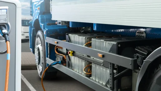
Access an up-to-date repository of EV data for direction mapping, including information on nearby charging points. Enjoy hassle-free EV routing with mapping solutions that include reachable ranges for your EV fleet.

Truck Routing
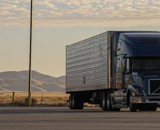
Simplify large-scale fleet management with the Azure Maps Truck Routing service. Generate the perfect route that accounts for local cargo restrictions and avoids road closures.
Ready to start building?

Get started
Building with Azure Maps API is as easy as signing up for free. Get API subscription keys, code samples, demos, and more on the Azure Maps API platform.

Documentation
Get instant access to detailed step-by-step tutorials, code snippets, and SDK support with our documentation base. Start building better today.

Samples
Learn how to perform various API calls for routing and visualizations with our interactive code sample gallery, including pre-written code snippets.
Frequently asked questions
-
You can start building right away by following our simple three-step process. Sign up for an Azure Maps subscription, create an instance on your profile, and get a subscription, or use a managed identity to start building your app. Please contact an Azure Maps expert if you have any questions about the platform.
-
The API provides plenty of flexibility for real-world usage. Developers can specify parameters like acceleration efficiency, the current amount of fuel in the vehicle, the type of fuel being used, and so much more. Visit the directions documentation page to view the full list.
-
Absolutely. Check out our multiple waypoints route demo for an interactive look at the API. You can also consult our code samples to get a closer look at how this Azure Maps service operates.
-
You don’t need to have prior mapping experience to start building with Directions. We provide up-to-date Azure Maps documentation for beginners and experts alike, covering everything from the basics to advanced guides.
-
Yes. Mapping directions for multiple sets of origins and destinations is easy with Azure Maps. You can do so either synchronously or asynchronously. Visit our route directions batch page to learn more.
-
No. Azure Maps API supports batch geocoding and reverse geocoding, allowing developers to convert hundreds of addresses into geographical coordinates (or vice-versa!) with a single call. You can batch geocode long lists of addresses and use the output to route with the Directions API.
-
Yes. You can easily integrate Azure Maps’ Routing APIs with other Azure services using the Azure platform. For instance, you can instantly import spatial data stored on the Azure platform to create visualizations.
-
Yes. Azure Maps API supports up-to-date EV data to simplify routing for EV vehicles. Developers can access accurate information on charge capacities, maximum ranges, and other key metrics for specific vehicles and create routes that account for them.
Related Content
Display Route Directions Tutorial
This detailed routing tutorial includes step-by-step instructions to help you generate a route and visualize it using layers.
A to B Directions
Find out how to get simple directions to go from point A to B with this detailed tutorial, including a code snippet.
Route REST API
The Route REST API directory includes everything you need to know about creating optimized routes, including tutorials.
Routing Coverage
Get detailed data on Azure Maps’ routing coverage, including the supported types of information for API calls.
More features from Azure Maps

Data and Insights
Process and analyze massive amounts of real-time and historical location data with Azure Data services to find the best possible solutions to logistics challenges.

Location Services
Map supply chains, locate POIs, and create customized experiences with powerful geolocation data, all backed by robust search APIs and extensive GIS databases.

Mapping and Visualization
Create varied, fully customizable, and interactive graphs that inform creative decision-making. Experience a new way of visualizing your data.


