Developing advanced mapping software that integrates historical weather data is crucial for industries like agriculture, logistics, and urban planning. Microsoft’s Azure Maps, a robust platform, offers sophisticated services such as weather APIs for research and visualization. This article explores Azure Map’s historical weather API capabilities, highlighting its potential and providing a guide to each of the available API calls.
An introduction to Azure Maps
Azure Maps is a comprehensive geospatial platform that offers services such as routing, traffic analysis, time zones, and weather data through REST APIs. It integrates seamlessly with other Azure services, enabling developers to build applications that analyze and visualize historical weather data.
One of Azure Map’s most notable features is its suite of weather services, which includes APIs for current, forecasted, and historical weather data. A key offering is a weather history API, which provides past weather information for data-driven decision-making.
Historical weather data in Azure Maps
In 2022, Azure Maps introduced significant updates, including historical weather data, air quality reports, and tropical storm tracking. These services are invaluable for conducting research, creating trend analyses, and developing predictive models using decades of weather data APIs.
Key data types available in Azure Maps include:
Daily historical actuals
- The daily actuals API provides observed historical weather metrics such as temperature, precipitation, snowfall, and snow depth for specific dates and locations.
- Accessible for up to 31 days in a single API call.
- Example use case: Temperature history API queries for specific cities over specific periods.
Daily historical normals
- The normals API offers average weather conditions calculated over a standard 30-year period for a given date and location.
- Ideal for identifying seasonal trends.
Daily historical records
- The records API includes extreme weather records like the highest/lowest temperatures and maximum precipitation for specific locations and dates through the historical weather API.
- Perfect for long-term weather data analysis.
Hourly weather history API
- Provides granular historical weather data on an hourly basis, offering deeper insights for precise analyses.
- Example: Researching hourly precipitation for disaster planning.
APIs for historical weather integration
Custom weather API solutions powered by Azure Maps empower developers to create tailored applications by combining historical weather data with mapping functionalities. Here’s a step-by-step approach to implementing these capabilities:
- Set up an Azure Maps account: Create an Azure Maps account via the Azure portal to generate your authentication keys.
- Authenticate requests: Use the subscription key to authenticate API calls. Include the key in the query or headers.
- Access historical data: Query the appropriate weather archive API to fetch historical weather data specific to locations, dates, or times.
- Integrate into applications: Combine climate data APIs with mapping functionalities to provide users with rich data overlays.
- Leverage data visualization for weather: Use map visualization tools to create heatmaps, trend graphs, and geospatial overlays that communicate weather trends effectively.
Practical applications
Integrating historical weather data into mapping software has numerous applications across industries:
- Agriculture: Farmers can use the Weather API to evaluate historical precipitation and temperature data, optimizing planting schedules and resource allocation.
- Logistics: Transportation companies can analyze historical climate tracking APIs to identify patterns that optimize delivery routes and minimize delays.
- Urban planning: City planners can access long-term weather data APIs to design infrastructure resilient to climate fluctuations.
- Energy management: With the historical weather data APIs, utilities can predict energy demands by analyzing historical weather and temperature patterns using weather data analysis tools, ensuring efficient resource allocation.
For an example of how to retrieve historical weather data using the Azure Maps Weather REST API, explore this sample application.
Advanced features
- Historical climate tracking: The historical weather APIs enable organizations to track changes in climatic patterns over decades, critical for assessing long-term environmental impacts.
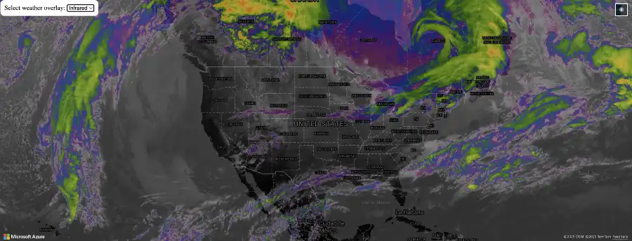
- Weather data visualization: Using Azure Maps’ visualization capabilities, developers can overlay data on maps, creating compelling visual representations of weather trends and extremes.
Factors to consider when building advanced mapping software
- Data availability: The extent of historical weather data varies by location, with some areas offering data spanning over 40 years. Always verify coverage for your area of interest.
- Accuracy and validation: Azure Maps sources data from reputable providers like AccuWeather, ensuring reliability. However, validate critical historical weather data for research or compliance purposes.
- Cost management: Be mindful of API usage limits and associated costs when planning applications.
- Integration options: Combine weather data with demographic or economic datasets for comprehensive insights.
Build with Azure Maps
Azure Maps offers developers a powerful platform to build advanced mapping software with integrated historical weather data. By utilizing services like the climate data API and historical weather integration, businesses can make informed decisions across sectors.
With visualization tools and historical weather data APIs tailored for long-term and hourly weather analysis, Azure Maps is a cornerstone for innovation in weather-centric application development.
Start building for free with Azure Maps.