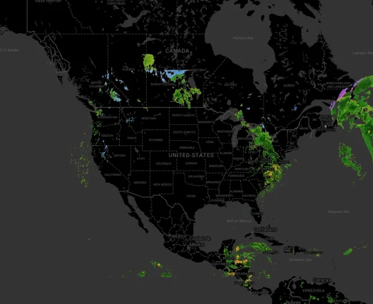
Geocoding, a process that allows users to convert addresses into accurate latitude and longitude coordinates, acts as a vital bridge between physical locations and the digital information that powers today’s Geographic Information Systems (GIS). Learn all about geocoding APIs, GIS, and everything in between with this Azure Maps overview.
What are Geographic Information Systems?
Geographic Information Systems (GIS) are tools that can help store, analyze, and visualize geospatial data. These systems allow us to visualize and analyze our world with multiple layers of information. Geocoding and reverse geocoding both play integral roles in GIS.
GIS provides a framework for uncovering spatial patterns and relationships that might otherwise remain hidden. We can gain deeper insights into complex challenges by analyzing the interplay between a location and factors like population demographics.
For example, a business looking to expand into a new area with multiple outlets can use a GIS to map its existing coverage and its competitors’ locations. An additional overlay showing population figures for different neighborhoods can help them identify gaps in the market and determine optimal locations for new outlets.
Geocoding, reverse geocoding, and GIS
Geocoding plays a pivotal role within Geographic Information Systems. Geocoding enables us to take addresses or place names and convert them into precise coordinates, effectively visualizing that data as a precise point on a map.
This geocoded data becomes a fundamental building block for spatial analysis within GIS. By associating data with specific locations, we can explore patterns, relationships, and trends based on:
- Geographic proximity
- Density
- Distribution
…and more. Modern GIS relies extensively on geocoding to provide dynamic solutions for organizations.
Reverse geocoding is just as important for GIS. This process allows us to translate coordinates, which humans do not interpret easily, into meaningful descriptions like street addresses and city names. For example, a navigation app could use reverse geocoding to display the user’s current location as a street address.
Geocoding and reverse geocoding are also crucial for a wide range of other applications, such as route optimization and geolocation. The Azure Maps Geocoding APIs facilitate this by allowing for seamless integration with other Azure Maps APIs.
The applications of geocoding in GIS
Data integration and management
Organizations often work with large sets of data stored in non-standardized forms, including street addresses and partial components of addresses. Businesses operating across multiple regions, such as an international logistics provider, may have even more variation in their datasets.
This variation can increase the chances of errors and glitches if operators work with non-geocoded addresses. Typos and inconsistent address formats can end up being very expensive in such situations.
Geocoding and reverse geocoding services allow organizations to process that data into a more standardized format. This data can easily and efficiently be stored for future use and manipulated while minimizing the chances of human error.
Spatial analysis
Once addresses are geocoded, they become spatial data that can be managed and analyzed within a modern GIS.
- Perform Queries: GIS tools allow us to perform spatial queries on geocoded data, such as finding all customers within a certain radius of a store. These queries can be converted back into street addresses using a batch reverse geocoding API.
- Create Visualizations: Geocoding, reverse geocoding, and visualization tools go hand-in-hand. Geocoded data can help create thematic and interactive maps that visualize trends across geographic areas.
- Monitoring: Geocoding and GIS play a key role in environmental monitoring and analysis. Geocoding environmental sensor data, for example, allows researchers to track pollution levels or wildlife populations across regions.
Service-based applications
Geocoding is absolutely essential for any scalable location and service-based application. Geocoded data is easier to process both on-device and in the cloud before it’s sent to individual users, reducing latency and creating a more convenient experience for users.
Consider, for example, a travel-oriented routing app. Geocoding and reverse geocoding would enable users to search for points of interest (POIs) near their current location, a specific address, or even a planned route. For developers building with Azure Maps, this location service is powered by the Post Search Along Route API.
GIS: Challenges and the Future
Modern GIS is already incredibly powerful, handling massive datasets and helping global organizations make consistently effective decisions. However, they still have to contend with a few challenges, such as:
- Inaccurate, incomplete, or inconsistent address data can reduce the reliability of location-based analysis.
- The need for a standardized address format across different regions and even countries that can improve the accuracy of relative geocoding and reverse geocoding.
- Geocoding and GIS accuracy can be limited in areas with incomplete or outdated address databases, particularly in developing countries or remote regions.
Advancements like integration with big data and notable developments in machine learning are helping researchers navigate these challenges. Machine learning, in particular, can offer a promising way to geocode accurately for remote locations.
Experience a cutting-edge geocoding system
Azure Maps’ Geocoding APIs are already helping thousands of organizations worldwide make a bigger impact, powered by high-quality geospatial data. See what an advanced geocoding algorithm can do for your organization today. Sign up for a free Azure Maps account to get started and get $200 in free Azure credit.


