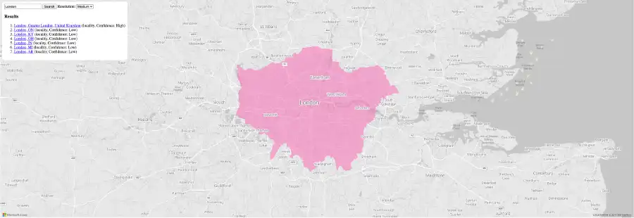
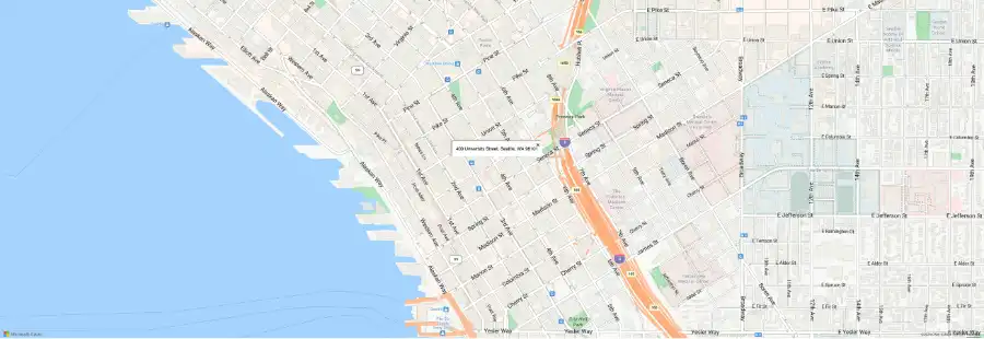
 The Azure Maps Geocoding APIs offer a suite of powerful features that are essential for any robust location-based app. From global coverage to support for massive batch requests and reverse geocoding, these APIs can be the backbone of your next application. Find out everything you need to know with this quick guide.
The ideal geocoding suite
These APIs cover a range of crucial location services, from optimizing the user experience to enhancing the accuracy of each geocoding request. Let’s take a closer look at some key APIs:
- Get Search POI API: This API allows users to look up relevant points of interest based on a given set of coordinates. Each Azure Maps geocoding request can be adjusted to suit your needs.
For example, you can look for juice bars around a specific location by using the query parameter. This feature can be extended to a wide variety of use cases. For example, an EV navigation app can use the API to look for charging locations around rest stops at regular intervals.
- Get Search Fuzzy API: This is ideal for situations when you need to perform a combination of geocoding and POI searching. This Fuzzy Search API can handle a combination of fuzzy inputs, including addresses, points of interest, and address components. Developers using the Azure Maps geocoding service can conveniently perform these searches with a single-line request.
- Search Along Route API: This Azure Maps Geocoding API is an extension of fuzzy search. The Search Along Route API allows you to find points of interest or addresses along a specific route.
You provide the API with a set of coordinates that define your route and what you’re looking for (restaurants, hotels, etc.) The API will then return a list of relevant locations that meet your search criteria, along with details like their distance from your route. This distance can even be adjusted with the maxDetourTime parameter.
- Get Reverse Geocoding API: The Azure Maps reverse geocoding service is the opposite of standard geocoding. Instead of taking a text-based address and converting it to coordinates, reverse geocoding takes coordinates as input and outputs a text-based description of the location.
This reverse geocoding API allows you to input a set of coordinates and receive a response that includes details about the location, such as street address, city, state, country, and even point-of-interest information. A delivery tracking app might use this to convert the current coordinates of a package back into a street address for the user’s convenience.

Batch efficiency
Azure Maps supports batch geocoding and batch reverse geocoding. Developers building with Azure Maps Geocoding APIs can efficiently geocode large sets of addresses simultaneously instead of sending individual geocoding requests for each address. This lets you:
- Save resources: Reduce the number of API calls required, potentially lowering your overall API usage costs. Sending coordinates from your servers to each app is also significantly faster than sending full text-based addresses.
- Save effort: Working with full-length addresses can be very time-consuming, especially if you’re working with hundreds of addresses on a daily basis. Coordinates are easier to manipulate and can be used to convey information through a visualization, like a heat map.
- Increase accuracy: Address formats can vary from one region to another. This discrepancy can introduce a larger margin for error. The Azure Maps geocoding service allows developers to minimize the chances of runtime errors and glitches by converting their input data into a format that is equally accurate across regions.
How does geocoding work?
Geocoding involves two main elements: the input data and the geocoding algorithm. These algorithms can vary significantly from one provider to the next. The efficiency of an algorithm will determine how long geocoding requests take, as well as their overall accuracy. The Azure Maps Geocoding APIs support both forms of input data:
- Absolute: This data is independent and specific. This could be a standard street address for a restaurant like ‘Joe’s Pizzeria, 42nd St., 10021, NYC.’
- Relative: The Azure Maps geocoding service also supports relative input data, making it perfect for applications developed for the wider public where exact searches might be less frequent. A relative input depends on another, more specific location. For example: ‘the store behind Joe’s Pizzeria.’
When a developer sends a POST request containing an array of addresses to be geocoded, the inputs are interpolated to arrive at an accurate set of coordinates. This process is backed by Azure Maps’ massive repository of high-accuracy geospatial data, which helps maximize the accuracy of every result.
Seamless integration
The Azure Maps geocoding service can be seamlessly integrated with other Azure Maps APIs. This integration unlocks a world of possibilities, allowing you to build richer, more sophisticated location-based applications.
- Navigation + Geocoding: Combine geocoded addresses with the Azure Maps Routes and Directions APIs to calculate optimal routes, provide turn-by-turn navigation, and estimate travel times. Ride-sharing apps and delivery services alike can easily cut down on delays by staying one step ahead of the crowd, all the time.
- Incident Management + Geocoding: The Azure Maps Geocoding APIs work perfectly with spatial data services like the Traffic API. Integrate geocoded locations to display real-time traffic conditions and identify road closures well in advance.
- Data Visualization + Geocoding: The Azure Maps geocoding service can bring your existing data to life. Enrich your datasets with spatial context by geocoding addresses, then leverage Azure Maps’ visualization capabilities to create interactive maps that reveal hidden insights and empower decision-making.
Build better with Azure Maps API
The right geocoding service is the foundation of an efficient and scalable location-based app. Start building yours by signing up for a free Azure Maps account. Get $200 in free Azure credit when you sign up today.

