This collection of REST APIs provides powerful functionalities related to geographic location and spatial context. In other words, developers can use this API to create intelligent location-based services and applications catering to a wide range of users. Whether you’re building for businesses or consumers, here’s everything you need to know about Azure Maps’ location services.
Search API
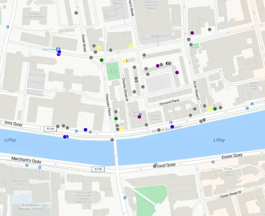
Azure Maps Search APIs are endlessly adaptable and can suit a wide range of use cases, from a simple map displaying points of interest in a target area to a full-fledged logistics dashboard. Let’s take a closer look at why search is an essential part of the Location Services APIs.
- Point of Interest Search: POI search allows applications to provide users with information that is directly relevant to their current location and context. This feature is a must-have, considering today’s consumers strongly prefer experiences tailored to their needs.
POI search can be customized extensively depending on your needs. In practice, this can range from a simple POI lookup based on the user’s location to a route-based search that highlights certain points of interest along a planned route. For instance, a logistics company can easily look up and highlight gas stations and restaurants along a predetermined route for its drivers.
- Fuzzy Search: This Location Services API ensures that users can find the desired locations and information even with imperfect or incomplete queries. Developers can use this feature to significantly improve the overall user experience by accommodating user error. Typos are natural and inevitable, and any reliable location-based application or service should be able to account for them.
- Autosuggest: Autosuggest significantly speeds up the search process by providing users with relevant suggestions as they type, eliminating the need to manually enter the entire address or name.
Geocoding API
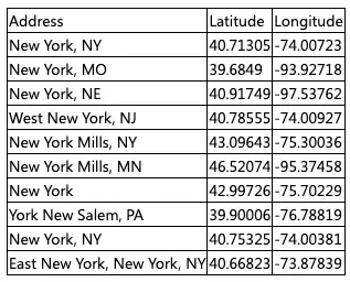
Geocoding services are a core component of Azure Maps, unlocking a wide range of possibilities for location-aware applications. As a core Location Services API, geocoding enables the conversion of street addresses into geographic coordinates (latitude and longitude).

The Geocoding API turns what would otherwise be a time-consuming process into something that takes just milliseconds. Coordinates are significantly easier to store, manipulate, and perform spatial calculations with.
- Easy Integration: As a business, the last thing you want to do is re-organize your existing data to get it to work with new mapping software. Azure Maps APIs offer seamless integration, so you can import your existing addresses and start using the Geocoding API right away with the Azure Portal.
- Batch Geocoding: Our Location Services APIs support batch geocoding for up to 100 queries using a single API call. This is especially useful for logistics businesses that work with a massive amount of spatial data on a regular basis.
- Reverse Geocoding: A robust location-based application or service should also be able to turn a set of coordinates back into street addresses and locations. The Geocoding API provides that functionality by supporting reverse geocoding. You can also reverse geocode batches of coordinates.
Geolocation API
Imagine being able to build apps that can instantly know where your users are and provide tailored experiences for every single one of them. That’s what this Location Services API enables!
The Geolocation API gives developers the tools they need to quickly and accurately determine the geographic location of any IP address. Resolving IP addresses into ISO country codes is necessary for any business that wants to craft customized experiences. This could be something as simple as a language-learning app that automatically detects a region change, or an ecommerce store switching its language to Spanish after detecting a Spain-based IP address.
Getting started with the Location Services APIs
This quick look at the location-aware features offered by Azure Maps APIs barely scratches the surface. Developers can achieve a lot more when they build with Azure Maps. These APIs can easily be integrated with each other to build location-based applications and services, and the possibilities are nearly limitless.
Azure Maps offers developers all the support they might need to unlock those possibilities and craft genuinely engaging and worthwhile experiences for users. Let’s run through some of the tools at your disposal here.
Documentation
Our documentation base contains everything you need when building with the Location Services APIs. The documentation is easy to navigate and caters to a wide range of developer skill levels. Whether you’re just starting out with mapping APIs or you’ve worked with them before, you’re going to find a ton of helpful insights to accelerate the learning process.
Code Samples
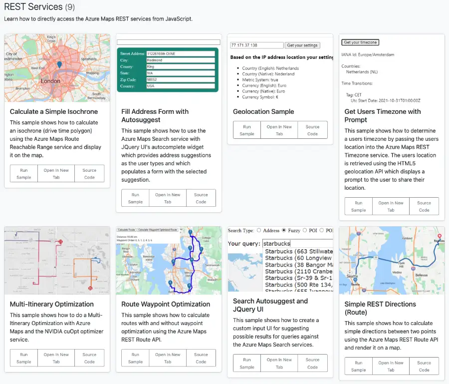
The Azure Maps code sample gallery is an invaluable resource for developers, offering in-depth and interactive looks at a variety of major APIs. If you’re interested in a particular sample, you can also run the code directly from your browser to see it in action. Developers can also take a look at the actual source code for these samples on our GitHub page.

Build with Azure Maps today
Ready to start building? Sign up for free on the Azure Portal and get $200 in free Azure credit instantly. Access the Location Services APIs for free and discover how Azure Maps can help you build better location-based services and applications.


