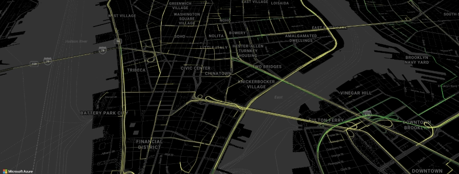
The convergence of cloud computing and geospatial technologies is quickly changing how we collect and analyze spatial data. Azure Maps API is at the forefront of that transformation, providing a cloud-based platform that empowers non-governmental organizations, businesses, and individuals with high-quality mapping data and spatial analytics to make meaningful decisions. Take a closer look at the future of geospatial intelligence with Azure Maps.
Making an impact with Azure Maps
The true potential of Azure Maps can best be seen through its most common use cases as a platform to harness geospatial insights.
Transportation and logistics
Asset tracking and accurate routing are both cornerstones of modern logistics, and Azure Maps API makes it easier than ever to help fleets get from point A to B. Logistics providers can use location data to simplify fleet management with Azure Maps, solving everyday problems with spatial intelligence.
- Routing challenges can easily be solved with the Routing API. A delivery company seeking to minimize travel times and fuel costs can use the Routing API to calculate the most efficient routes for a given vehicle, considering its height, weight, and other specifications. The API can also account for road closures and hazardous material restrictions, saving delivery agents the hassle of re-routing midway through a trip.
-
- The Batch Geocoding API is a key Azure Maps service that is crucial for many real-world routing applications. Fleet managers, for instance, can convert long lists of addresses into geographical coordinates in mere seconds, making it easier to store and manipulate location data. These coordinates can then be used to find points of interest along a given route, such as hotels or gas stations.
- Organizations can build robust asset management systems to enhance logistical operations by using Azure Maps API as a foundation. Azure Maps makes it easy for developers to integrate IoT sensor data, satellite imagery, and other external data stored within the Azure service.
Emergency response
Geospatial data management is key to emergency response and disaster management. Azure Maps helps organizations direct emergency response and relief efforts with a suite of mapping APIs.
For instance, location data can be used to visualize and track incidents with the Mapping and Visualization APIs. Dispatchers can pinpoint the exact location of incidents on a map, create an overlay of nearby POIs like hospitals and fire stations, and track traffic conditions to determine the best possible routes for responders.
Urban planning and smart cities
Azure Maps directly contributes to developing greener and more efficient urban environments. Governments can analyze movement patterns and population densities to gain deeper insights into how people interact with their complex ecosystems. In this context, Azure Maps services are crucial for enabling data-driven infrastructure planning and resource allocation decisions.
For example, integrating IoT sensor data with location data allows urban planners to map regional pollution levels and understand urban dynamics effectively. City officials can use this information to plan new measures to reduce pollution, enhancing the quality of life of thousands of individuals.
Retail and customer engagement
Navigating today’s complex retail environment is difficult without a reliable geospatial data management solution. Azure Maps helps businesses solve everyday retail challenges and boost customer engagement with more personalized services.
- Personalized Recommendations: The Search API gives retailers the power to create personalized customer experiences. Online stores can generate personalized recommendations based on a user’s current location. For example, a buyer looking for ‘coffee shops near me’ could be presented with a detailed list of nearby options, including opening times and customer reviews for each shop.
- Targeted Promotions: Similarly, location data can be the foundation for targeted promotional campaigns based on customer locations. Retailers can use the Search API to identify potential buyers and deliver targeted ads near their outlets. A clothing store, for instance, could advertise waterproof jackets to customers located in areas with regular rainfall.
- Market Analysis: Reliable data is everything in the world of high-stakes business decision-making, and Azure Maps services deliver when it counts. Businesses can leverage Azure Maps’ location intelligence to analyze a retail market and optimize expansion strategies, minimizing risk and maximizing their growth potential.
For instance, a retail heat map can help retailers identify new opportunities with location data. Managers can zero in on areas that are highly concentrated with their target customer base and lacking in competitor outlets.
The future of mapping starts here
Azure Maps API is at the cutting edge of geospatial intelligence, enabling better decisions with high-res imagery, accurate geospatial data, and so much more. Whether you’re localizing apps for an international audience or managing massive fleets, Azure Maps moves with you. Create a free account and start building with Azure Maps today.

