


Leveraging the vast potential of satellites and space-based infrastructure to bring seamless and ubiquitous connectivity to even the most remote areas.
Related projects

Artificial intelligence training in space
Large-scale deployments of low Earth orbit satellites collect massive amount of Earth imageries and sensor data, but it is increasingly infeasible to download all the high-resolution images and train the corresponding AI models on the ground. In this project, we focus on novel distributed and federated learning frameworks (opens in new tab) that enables ground stations and satellites collaboratively train AI models without downloading all the data to the ground.
Related vertical(s): Edge computing

Cloudification of network stack for IoT in space
The “new space” revolution is bringing about a new era of innovation and possibility in the industry as private companies are pushing the boundaries of what is possible by launching thousands of Low Earth Orbit (LEO) satellites. One of the most exciting developments is the use of small IoT picosatellites (picosats) that envisions offering a cost-effective way to connect millions of IoT devices around the world that may not have access to terrestrial networks. The small size and low-complexity hardware of these satellites make them easy to build and launch into orbit, resulting in rapid scaling of IoT picosat networks. As picosat constellations scale, their traditional networking stack becomes the bottleneck because it does not incorporate constraints specific to picosat constellations. In this project, we innovate a new end-to-end networking stack for IoT in space by introducing cloudification of the network stack.
Related vertical(s): IoT

Context-aware compression of satellite imagery in space
Transmitting raw space imagery data to the ground for processing presents difficulties due to limited network bandwidth, resulting in data being captured in restricted modes and taking hours to days to downlink. To address this, compression right in space is a more promising approach to reduce the amount of data transmitted. However, current compression techniques treat all pixels as having equal weight, despite not all parts of an image being equally important. Our proposed solution, Earth+, is a smart filtering and compression method that is implemented directly on the satellite. Earth+ leverages the rich historical dataset on earth to intelligently select a reference image that best represents the near future and uploads it to the satellite. Utilizing lightweight context-aware cloud detection and diff-based comparison, Earth+ identifies only the changed areas and transmits them back to earth, thereby significantly reducing data transmission volume.
Related vertical(s): Edge computing
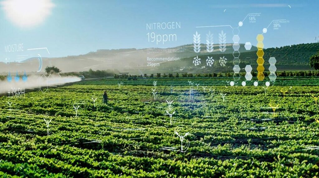
FoodVibes: Wireless sensing and communication for food supply chain traceability
At Microsoft Research, we are working towards a fully digitized and connected supply chain for agriculture and food. With the growing human population, there is a need to responsibly and sustainably meet the global food demands. Towards this goal, FoodVibes identifies critical traceability points in the global Agri Food Industry that are responsible for inefficiency and applies technological innovation to address key challenges faced by the industry. By leveraging our research in wireless communication, battery-free and IoT sensing, we are establishing traceability for key metrics related to nutrition, sustainability, and quality of the food that nourishes the global population. Some of these key challenges being addressed include creating traceability from farm to fork, especially for bulk commodities like grain, tracking the produce environment during transport and storage with novel sensing infrastructure and a communication scheme to ensure global connectivity to support this supply chain.
Related vertical(s): IoT | Ultra-low-power connectivity

Kodan: Edgifying satellite applications for on-board computation in space
The decreasing costs of deploying space vehicles to low-Earth orbit have led to the emergence of large constellations of satellites. However, the high speeds of the satellites, the large sizes of image data, and the short ground station contacts have created a challenge for data downlink. Orbital edge computing (OEC) can filter data at the space edge and address the downlink bottleneck, but it shifts the challenge to the limited computation capacity onboard satellites. We present Kodan, an OEC system designed to maximize the utility of saturated satellite downlinks while mitigating the constraints of the computational bottleneck. Kodan has two phases: a one-time transformation step that uses a reference implementation of a satellite data analysis app, along with a representative dataset, to produce a set of specialized ML models targeted for deployment to the space edge. After deployment to a target satellite, a runtime system dynamically selects the best specialized model for each data sample to maximize valuable data downlinked within the constraints of the computational bottleneck.
Related vertical(s): Edge computing

Low latency distributed downlink for low Earth orbit satellites
Low Earth orbit (LEO) satellites for Earth observation and IoT have become very popular in recent years. The earth observation satellites collect hundreds of Gigabytes of imagery during their orbit. This data needs to be downloaded using ground stations on Earth. However, due to the low altitudes, the satellites move fast with respect to a ground station on Earth, and consequently, have a few minutes time window to download the data to a single station. Although an LEO IoT satellite aggregates comparatively much lower amount of data, it uses very low data rate link to download the data. It, in turn, has a very negative impact on the freshness of data and overall throughput of the satellite networks. We propose a geographically distributed ground station design, DGS that improves robustness and reduces downlink latency. DGS is the first system to use a hybrid ground station model, where only a subset of ground stations are uplink-capable.
Related vertical(s): IoT

Spectrum sharing between satellite and terrestrial networks
In a world where space and terrestrial networks are expanding at an unprecedented pace, it is critical to ensure that the radio spectrum, a finite resource, is utilized to benefit both types of networks. To achieve this, it is essential to have an inclusive spectrum management technology that can facilitate efficient spectrum sharing. We introduce our innovative solutions that enable spectrum sharing in two ways. Firstly, our cutting-edge NextG AI-driven spectrum database creates a new spectrum awareness service that ensures effective management of the spectrum. Secondly, our spectrum exploitation techniques leverage satellite artifacts that embed unique attributes in the RF signal transmitted from each satellite, enabling coexistence with other networks. Our innovations have been tested and evaluated in a real-world satellite network, providing compelling evidence of their efficacy. With these groundbreaking solutions, we are confident that we can overcome the challenges of managing the radio spectrum and drive forward a new era of progress and innovation in both terrestrial and space networks.
Related vertical(s): IoT | New spectrum and sharing