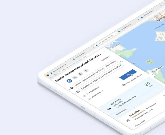
An advanced suite of APIs
Innovate with location data to unlock the full potential of your web and mobile applications. The Azure Maps platform’s REST APIs and Web SDK provide an advanced suite of mapping and geospatial services designed to empower developers and organizations to create cutting-edge, location-based experiences.
Integrate dynamic maps, precise geocoding, intuitive location search, efficient routing, traffic insights, accurate geolocation, comprehensive timezone details, and up-to-date weather information into your own public or private solutions.
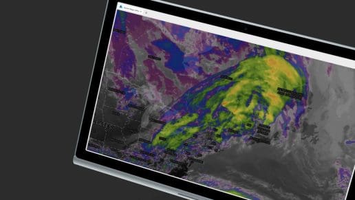
Data and Insights
Access accurate current and historical data to build location-aware applications and support business decisions.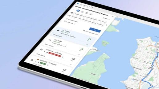
Location Services APIs
Integrate location-based functionalities into your applications with peerless location intelligence.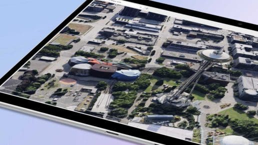
Mapping and Visualization APIs
Drive impactful business decisions and extract invaluable insights from your spatial data with our map APIs.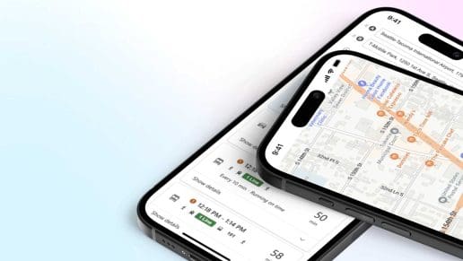
Routing and Directions APIs
The fastest route to any destination goes through Azure Maps. Create location-aware routes based on accurate geospatial data.Bring your ideas to life with Map APIs
Location is becoming a key attribute of the data used by businesses and individuals, but location data usually comes in various types and formats that make it hard to work with or take action on. Our APIs make location data usable and actionable on a cloud platform that is scalable, secure, and innovative.
REST APIs and SDKs that make a difference
These APIs are designed to provide a seamless experience for developers and users alike as you integrate various geospatial services into your solution. Our platform’s REST APIs and SDKs allow you to deploy and scale effortlessly while providing superior value and cutting-edge services to your customers.

Efficient Fleet Management
Azure Maps ensures your fleet management is accurate, efficient, and always on the move. Utilize advanced mapping, optimizing traffic solutions to route and delivery routes, reduce transit times, and enhance logistical performance.

Interactive Experiences
Incorporate Azure Maps into your customer-facing platforms to deliver interactive and immersive mapping experiences. Let users locate stores, utilize dynamic route planning, and explore services based on geographical locations.

IoT Mapping and Management
Use powerful map APIs to visualize the real-time location of your IoT devices, optimize their paths, and monitor them for insights and analytics to manage, locate, and operate your IoT devices effectively and leverage spatial analytics for optimized resource utilization.
Why Choose Azure Maps APIs
Our APIs are built on Azure, which means you have minimal integration points, which gives you full visibility and redundancy for your application. First-party integration means you can innovate with all the services from Azure, including services available through the Azure Marketplace.
Innovate with Azure
Innovate by combining additional services from Azure and the Azure Marketplace to create custom solutions to address your unique needs. All with minimal integration and complexity.
Scale with confidence
Scale up or down your applications to meet your business needs with industry-leading global infrastructure. You can scale with confidence while abiding by data and privacy regulations.
Secure from the start
Azure Maps comes with built-in security, allowing you to get started quickly, thanks to Azure’s industry-leading security policies and standards. Supports over 100 compliance standards for any use case.
Map APIs that power innovation
Unlock the full potential of your business operations, optimize strategic decisions, and support your customers with the Azure Maps platform. Our platform is built to support innovation while remaining laser-focused on the demands of enterprise and small businesses.
Optimize your business
Location intelligence helps businesses determine optimal locations for new stores, offices, or facilities based on demographic data, competitor presence, and market trends. It also aids in route optimization for deliveries and logistics to reduce costs and improve service times.

Revolutionize urban planning
Urban planners use location intelligence to analyze population growth, transportation needs, and infrastructure development. It helps in designing more efficient public transport systems, optimizing road networks, and planning utilities and services to meet the needs of growing urban areas.

Empower environmental stewardship
By analyzing geographic data powered by our map APIs, environmental scientists can monitor landscape changes, track wildlife movements, and manage natural resources more effectively. Location intelligence is crucial for assessing disaster risks and planning for emergency responses.

Target your market effectively
Companies utilize location intelligence to target marketing campaigns based on geographic and demographic factors. It allows for more personalized marketing strategies, leading to higher engagement and conversion rates.

Get started with Azure Maps API
Azure Maps in action
Learn what Azure Maps can do for your organization with these Azure experiences.
What is the Azure Maps API?
Learn all about map APIs, including how they work and how to make the most of them, with this quick Azure Maps guide.
Getting the Most Out of the Azure Maps Location Services API
Unlock the full potential of the Azure Maps Location Services APIs with this brief overview.
Build Your First Location-Based App Using Azure Maps
Building location-based apps is easier than you think with Azure Maps. Get started with this guide.
A world of possibilities
The Azure Maps platform offers you and your users unmatched scale and coverage for geospatial mapping at your fingertips. Leverage flexible REST map APIs and SDKs to power maps, location services, and personalization across platforms.
Precision
Advanced AI and comprehensive datasets to offer precise location data and routing.
Insights
Optimizing operations, our platform delivers actionable insights tailored to your specific needs.
Integration
Easy-to-use APIs and SDKs. Integrate Azure Maps across platforms and devices.
Frequently asked questions
-
Azure Maps is a suite of geospatial services and tools designed to provide location intelligence for businesses. It includes high-quality maps, location search capabilities, routing options, traffic data, and more. These features can be integrated into your applications, websites, or services using REST APIs and SDKs.
-
Any Industry that needs to know where things are and visualize them can benefit from extending their solution with map APIs. Some examples include:
- Engineering and Manufacturing – Know where your resources are for critical project management and order fulfillment.
- Healthcare – Offer HIPAA-compliant appointment scheduling with routing to those appointments, including travel time.
- Banking, Finance & Insurance – Visually evaluate the risk for flood or other hazards for loan considerations, and more.
- Government – Improve resource planning for road maintenance, smart cities, or other projects.
- Retail & E-Commerce – Elevate customer service and sales by locating current and future retail stores and optimizing deliveries.
- Supply Chain – Unlock efficiency with improved visibility and control over your supply chain operations.
-
If you already have an Azure subscription, you just need to add an Azure Maps resource to your project and use that instance to call map APIs. You can find more information and check out samples to see the working code.
-
Azure Maps benefits from the security of the Azure platform. Get built-in compliance and the support of over 3,500 security experts dedicated to data security and privacy. Microsoft runs on Trust and spends over $1 billion annually on cybersecurity research and development to support that trust.
-
Azure Maps users enjoy the same support available for all Azure resources.

